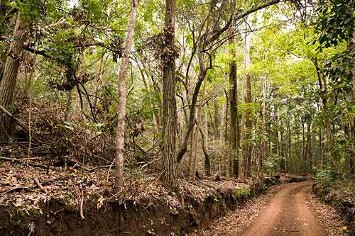
 The Munro Trail is a 12.8-mile winding dirt road that runs across Lanai's razorback spine leading to the summit of Mount Lanaihale (House of Lanai), the island's highest point at 3,370 feet above sea level. It is named after New Zealand naturalist George Munro who arrived in 1890 and introduced the majestic Cook pine trees to the island.
The trail, which weaves through a rainforest lush with ohia lehua, ironwood, eucalyptus and Munro's Cook pine trees, offers spectacular canyon and ocean views. There are several lookouts along the way and from the summit, visitors are given the opportunity to see other Hawaiian islands, including Oahu, Molokai, Maui, Kahoolawe, Oahu and the Big Island, all at once! On a very clear day that is.
While it can be hiked or biked, the trail is best tackled by a four-wheel drive and an expert driver. It includes some very challenging areas that can get worse due to heavy rains. The full drive will take about two to three hours while you can spend up to 7 hours hiking , depending on road conditions and how often you stop to appreciate the magnificent views. There are also no facilities along the trail, so come prepared with plenty of water, food and a full tank of fuel.
To get to Munro Trail, take Highway 440 north from Lanai City and past the Lodge at Koele. The highway becomes Keomoku Road. Turn right at Cemetery Road and follow the signs to the trail.